Rapid Response and Recovery after a Hurricane Using AI
For quick response and recovery in large scale after a natural disaster such as hurricane, access to aerial images is critically important for the response team. The emergence of small unmanned aerial systems (UAS) along with inexpensive sensors presents the opportunity to collect thousands of images after each natural disaster with high flexibility and easy maneuverability for rapid response and recovery. Moreover, UAS can access hard-to reach areas and perform data-gathering tasks that are otherwise unsafe or impossible for humans. Despite the ease of data collection, data analysis of the big datasets remains a significant barrier for scientists and analysts. While traditional analyses provide some insights into the data, the complexity, scale, and multi-disciplinary nature of the data necessitate advanced, intelligent solutions.
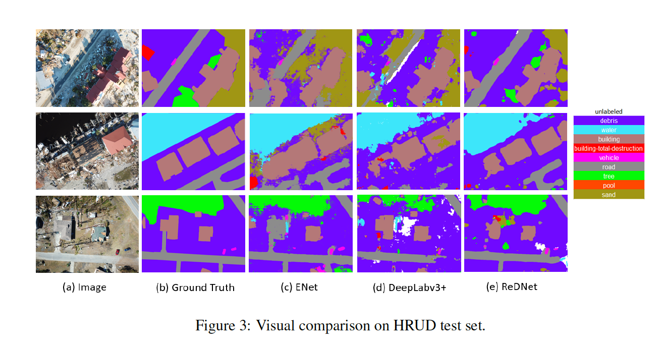
The primary objective of this project is to facilitate rapid response and recovery by developing novel artificial intelligent techniques for imagery collected by UAS after Hurricane Harvey and Michael. Using AI, we will identify the flooded areas, such as flooded houses and roads, and also the degree of damage to houses from high winds. The labeled data and developed model in this project, will help us to train the future disaster models faster and with higher accuracy.
This research is supported by Microsoft- AI for Earth fund.
Maryam Rahnemoonfar Principal Investigator
Robin Murphy Co-Principal Investigator
Tashnim Chowdhury PhD Student
Argho Sarkar PhD Student
Ashwini Bansod MSc Student
Michal Magidson Undergraduate Researcher
• Prof. Maryam Rahnemoonfar discussed 'Visualizing Flood Risk and Uncertainty' at #efsi2019