|
|
|

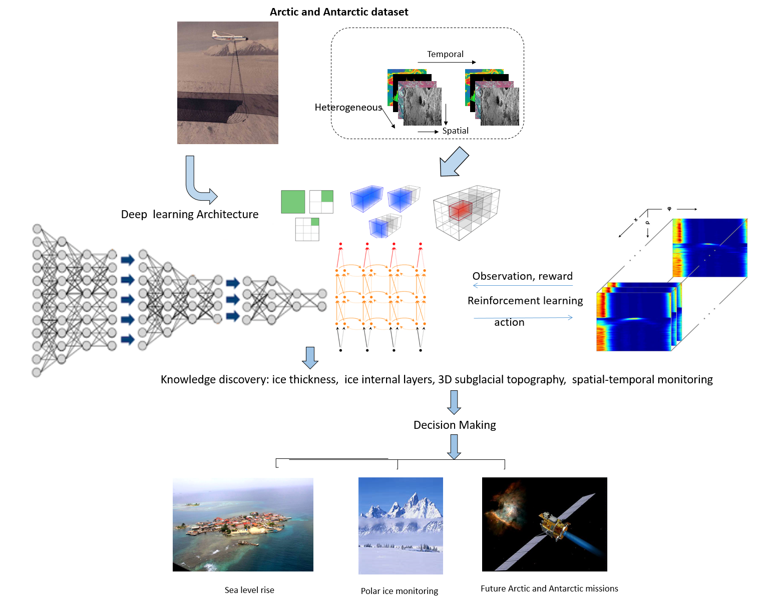
Ice loss in Greenland and Antarctica has accelerated in recent decades. Melting polar ice sheets and mountain glaciers have considerable influence on sea level rise (SLR) and ocean currents; potential floods in coastal regions could put millions of people around the world at risk. The Intergovernmental Panel on Climate Change (IPCC) estimates that sea level could increase by 26–98cm by the end of this century. This large range in predicted SLR can be partially attributed to an incomplete understanding of bed topography and basal conditions in fast-flowing regions of ice sheets in Greenland and Antarctica. Therefore, precise calculation of ice thickness is very important for sea level and flood monitoring. The shape of the landscape hidden beneath the thick ice sheets is a key factor in predicting ice flow and future contribution to SLR in response to a changing climate. Recent large-scale radar surveys of Greenland and Antarctica reveal internal ice layers on a continental scale. Our large-scale dataset enables accurate detection and tracing of these internal layers to illuminate many aspects of ice sheet dynamics, including their history and their response to climate and subglacial forcing.
Our goal is to provide an intelligent data understanding to automatically mine and analyze the heterogeneous dataset collected by CReSIS.


